
What about Carara National Park?
Carara National Park is located in the Turrubares and Garabito cantons, in the provinces of San José and Puntarenas, between coordinates 9º51′ and 9º44′ North latitude, 84º36′ and 84º29′ East longitude. In other words, it is 90 kilometers from San José on the Costanera Sur (southern coastal) highway. The main entrance is located 2 kilometers south of the Río Grande de Tárcoles bridge.
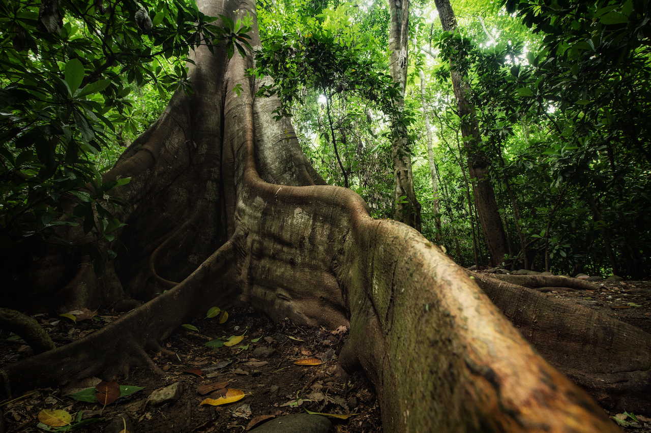
Carara means «river of lizards’ ‘ in the Huetar indigenous language, and has the only transitional forest in the Central Pacific, resulting in a diversity of flora and fauna where native species of both dry forests and rainforests converge.
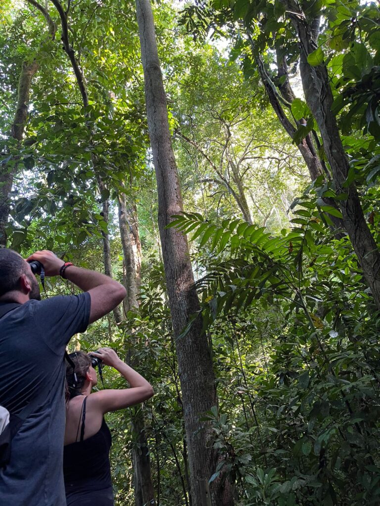
This national park is a world-renowned ornithological destination and has extremely diverse birdlife, specifically the scarlet macaw (Ara macao), an endangered species that is the second largest Psittacidae species in Costa Rica.
Without a doubt it is one of the main sites in the country for birdwatching, which is why it will be included in the next guide published by the Costa Rican Tourism Board for this segment of national tourism.
Because of its location and ease of access on Route 34, the park is ideal for a one-day visit, with easy access from the capital in your own car, in a rental car or by public transportation.
It is the first national park with a universal access path, where visitors can experience being in the forest and viewing endemic species like the giant Cafecillo (Erythrochiton gymnanthus), as well as observing the relationship between some of the species.
Originally Carara National Park was the La Gran Hacienda Coyolar, one of the largest private landholder’s property that has been in Costa Rica.
Initially, it was established as Carara Biological Reserve on April 26, 1978, by Executive Decree № 8491-A, subsequently its management category was changed to National Park on November 18, 1998, by Executive Decree № 27411-MINAE.
Attractions
Universal Access trail:
A distance of 0.74 miles (1.2 km) with nine resting bays; drinking water systems all the way; sanitation battery adapted to the requirements of the law 7,600 (Equality law opportunities for people with disabilities); labeling in Spanish, English, and Braille; maps with this system for blind people; sculptures; auditive system; QR code app, and most of the road has Wii-fi, among other facilities.
Las Aráceas Trail:
Circular trail of approximately 3.937 feet (1.200 meters) long, it takes about one hour. Gets its name from an important family of plants, Araceae. On this trail you can see plants growing on trees, one of those is known as Mano de Tigre (Monstera deliciosa) which is easily distinguished by its large and lobed leaves with small holes that allow the passage of sunlight pierces to other leaves and allows the plant to make efficient use of the limited sunlight it receives in the forest. Its long roots go down to the ground where they absorb the nutrients needed to live. Other examples of this family are the general Anthurium and Philodendron.
Laguna Meándrica Trail:
A little lineal trail around 6.561 feet (2000 meters) that runs between two and four hours. Its name is related to the meander formed in the Tarcoles River with a lake formed in the sector of approximately 1.968 feet (600 meters) long and 131 feet (40 meters) wide. On the river, you can observe crocodiles (Crocodylus acutus) and on the trail stands the Cafecillo (Erythrochiton gymnanthus). This trail is usually used by ornithologists to observe many birds, mainly in the morning.
Quebrada Bonita Trail:
Circular trail with a length of 4.265 feet (1.300 meters), it can be covered in approximately half an hour. Its main attraction is Quebrada Bonita, hence the name of this trail, where you can appreciate large and tall trees and climbing species, among others.
Ecosystem Meeting Point Trail:
It is a linear trail of 2.132 feet (650 meters) that connects the Quebrada Bonita trail with the universal access trail, among its attractions are bird watching and interpretation of forest and environment.
Flora y fauna:
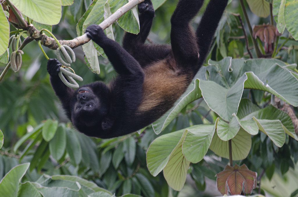
Among the fauna species that more feature it are howler monkeys (mono congo), three-toed sloth, agouti, armadillo, opossum, raccoon, and the scarlet macaw (Lapa Roja), emblem of this area.
According to scientific data, it presents the following records of flora and fauna:
- 480 species of plants, including trees and shrubs, with 14 endemic species and 29 species that are considered rare and endemic.
- 124 species of reptiles, corresponding to 53% of the species of reptiles in Costa Rica (234).
- 112 species of mammals, being 47.8% of these species in the country (237)
- 62 species of amphibians, being 32.8% of the 189 species of toad in Costa Rica.
- 420 species of birds, 47% of the 893 species reported in the country, are considered one of the most important sites in CR for observing birds in their natural state.
Services
- Drinking water
- Sanitation services
- Parking lot
Recommended
- It is recommended to use comfortable clothes and shoes as well as an insect repellent.
- During your visit, please stay on the trails, if any eventuality goes to the official’s area.
- Inside the park, smoking is forbidden in all areas: vehicular parking, restrooms, and trails.
- Help us keep clean areas, do not leave garbage or footprint on your visit. Within the trails, you will not find trash containers to deposit the garbage.
- It is not allowed to ingest alcohol and other drugs, protect the labels and take care of them.
- Enjoy nature properly, do not touch plants or wildlife.
- We invite you to walk the trails, when needing information please contact park officials.
- To walk the trails in the forest, it is recommended to use proper footwear, it is not recommended to wear sandals and try not to make noise, do not go out from permitted areas nor climb on sculptures or labels.
- Take care of your belongings.
- Do not interact with the animals, keep an appropriate distance from wildlife, and do not leave food available for them.