
What is Monteverde?
Geography
Topography
The community of Monteverde (1350-1500 m) lies on the upper Pacific slope near the Continental Divide in the Cordillera de Tilarán (Tilarán mountain range) in northwestern Costa Rica. The nearest town is Santa Elena (1250 m), a small rural village 35 km up the gravel road from the Río Lagarto turn-off on the Inter-American Highway. Monteverde consists of a diffuse array of dairy farms, hotels and residences spreading along a narrow plateau that drops off steeply on the southwestern side into the San Luis Valley and rises sharply on the northeastern side to the peaks and ridges of the Continental Divide.
At this point in the Cordillera, the Divide broadens into an irregular mesa with river canyons (quebradas), ridges and emergent peaks. The most notable peaks are Cerro Amigos («friends’ mountain») (1842 m) where the TV repeater towers are located, Cerro «sin nombre» («mountain without name») (1699 m). This mountain mass serves as the source for several major rivers that flow either northeast toward the Caribbean or southwest to the Golfo de Nicoya.
The main rivers on the Pacific side of Monteverde are the Río Guacimal, Río Lagarto, and Río Cañas. The Río San Luis joins the Guacimal at the village of San Luis (700 m) in the San Luis Valley below Monteverde. The largest rivers on the Atlantic side of Monteverde include the Río Chiquito and Río Caño Negro that empty into Lago Arenal and the Río Peñas Blancas that merges with several other large rivers before dumping into the Rio San Juan, which forms the northeastern border between Costa Rica and Nicaragua.

Natural areas
The Monteverde Cloud Forest Preserve (10,500 hectares or 26,000 acres) straddles the Continental Divide to the north and east of the Monteverde community. Access begins at the Preserve’s Information Center (La Casona), which can be reached by vehicle on an all weather road from Monteverde.
The Preserve has a well-maintained trail system in the area between the Information Center (1520 m) and the Divide (1580-1600 m), and a more primitive series of trails that extend out to the far reaches of the area. The MCFP is owned and operated by the Tropical Science Center, a private, non-profit association based in San José. The Santa Elena Reserve (about 310 hectares or 765 acres) lies on the high Atlantic slope and Divide to the north of Monteverde and Santa Elena. It can be reached by driving north from Santa Elena.
Geology and Soils.
The Cordillera de Tilarán consists mostly of andesite and rhyolite formed in volcanic eruptions and lava flows during the Tertiary period (12-60 million years ago). Most of the surface rocks are considered to be relatively young, about 3-5 million years old (Pliocene epoch). The gray sand (riolite) mined from quarries along the road to Monteverde, used for surfacing the roads and making concrete, originated from volcanic extrusion, and it is not sedimentary as many people think.
Soils of the Monteverde area are also volcanic, having developed from weathered volcanic rock and ash deposits. Where they are not badly eroded, these soils are deep and dark colored, rich in organic matter, medium textured and low to moderately fertile (with the appearance of topsoil). Where they have been heavily eroded on steeper terrain these soils are shallow, red-dish, low in organic matter, heavy textured and low to very low in fertility (with the appearance of red clay).

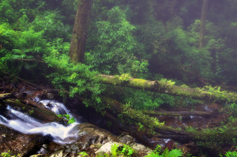
Cloud forest
On the upper Pacific slope: Above 1500 m is a dense forest of tall, straight trees with the canopy at 20-35 m (Lower montane wet forest life zone). On the higher peaks and upper Atlantic slope at 1400-1800 m, the cloud forest canopy is lower (15-20 m) and more broken because of its exposure to the strong northeast trade winds and seasonal wind storms (Lower montane rain forest life zone). The elfin forest, found along the windswept ridges of the Brillante Trail on the Continental Divide, and the swamp forest along the Pantanoso Trail in the Preserve belong in this category.
Receiving about 3 m of annual rainfall along with wind-borne mists and cloud cover blown in from the Atlantic side even during the dry season, this forest has a much less seasonal appearance than the moist forest lower down on the Pacific slope. Heavy epiphyte loads and tree bark hidden beneath layers of moss and epiphytes help identify this forest type. The uneven canopy and many tree falls provide sufficient light for a dense understory layer of shrubs and treelets, especially members of the Acanthaceae, Melastomata-ceae, Piperaceae and Rubiaceae, and large-leaved herbs (Calathea, Costus, Heliconia, Renealmia). Numerous species of herbaceous climbers and epiphytes such as aroids (Anthurium, Monstera, Philodendron), Cyclanthacee (Asplundia) and bromeliads (Guzmania, Pitcairnia) cling to the trunks. On the forest floor, the leaf litter dries out only a few days a year, usually during March and April.
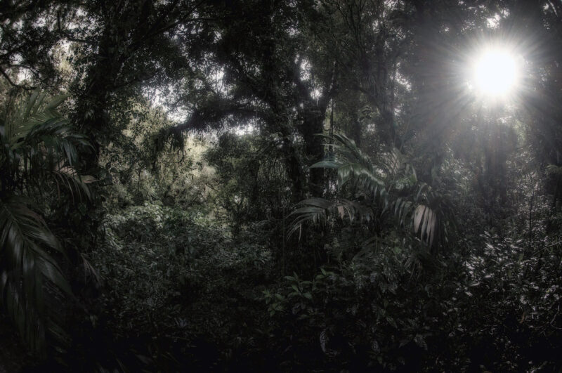
Atlantic slope rain forest. This forest type (Premontane rainforest life zone) is found on the Atlantic slope between 800 and 1400 m. Receiving 4-8 m of rainfall annually, it is constantly wet and almost seasonal. The higher ridges intercept the wind-borne clouds and mists even during the dry season, keeping the area socked-in and drizzly. A much taller forest with a canopy at 30-50 m occurs in the sheltered river valleys below 900 m. Fewer epiphytes occur here than in the cloud forest, but it is particularly rich in ferns, aroids, heliconias and other large-leaved herbs. This life zone shares a significant number of species with the cloud forest, but few species reach over as far as the Pacific slope moist forest.